Locatii
Prahova – E-mail : prahova@geoscan.ro – Telefon : 0724.522.200

Prahova – E-mail : prahova@geoscan.ro – Telefon : 0724.522.200

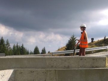
In the electromagnetic method (EM) there are recorded the values of an electric field induced into the ground for various investigation depths. The main applications of this method are the outlining and identification of the objects that have an electromagnetic field or of the objects producing a modification of the magnetic field of the zone. The electromagnetic measurements can be performed acoustically (by highlighting an acoustic signal in the case of intercepting a response from the induced electromagnetic field), and the areas with positive response will be recorded with the professional software. GEOSCAN uses electromagnetic equipment for the detection of the buried objects through the electromagnetic method. The maximum investigation depth is of 3 m depending on the size of the buried object, the magnetic permeability of the soil and of the electromagnetic noise specific to the area. All geophysical measurements will be positioned in the field with a GPS system using national or international coordinates. Applications of the electromagnetic method : – detection and localization of ammunition and unexploded bombs (UXO) buried, – detection of buried utilities into a homogenous medium (ducts, pipes, electric cables), – detection of buried metallic objects.

Resisitivity method is a geophysical method successfully used by decades. By Resistivity we measure the resistance of underground materials to the passage of electric current. Resistivity involves injecting current through two or more electrodes and measuring the response of the underground materials using other two or more electrodes; voltage decrease is due to the water content and to the electrical conductivity of various rocks. All data recorded in the field are sent to a laptop for viewing and interpretation using DataViewer software. Applications of Resistivity method (VES): – Local and regional geology issues (bedrock identification) – Areas with landslides, – Determination of groundwater depth, – Correlation of geologic layers, – Issues of economic geology (determination of salt structures and of the areas with useful rocks, etc.), – Issues of hydrogeology (determination of the layers of freshwater and mineral water), – Issues of technical geology (determining the nature of the rocks, their depth and topography, the geotechnical features of the soil).

With the aid of the magnetometric geophysical method we are measuring Earth’s magnetic field and its variations given by the encountered underground structures (pipes, pipings, cables under voltage, voids, geology, bombs, etc..). The investigation depth is based on the antenna used. Images are processed in real-time using the application named Visualizer 3D, allowing an immediate interpretation of field and subsequent detailed analysis. Applications of geophysical magnetometric method : – Detection and localization of buried utilities ( cables under voltage, pipes, pipings), – Locating old foundations, – Detecting voids and caverns, – Contouring fillings, – Mines clearing and detection of unexploded bombs, – Highlighting differences of materials, – Locating archaeological sites.

GEOSCAN is a private company specializing in geophysical, geological, surveying, environmental studies and consulting services. GEOSCAN operates national and international projects, offering flexible services with applicability in residential and commercial buildings, roads, bridges, railways, wind and photovoltaic parks, soil and subsoil pollution. We apply non-invasive techniques for analysis of underground based on magnetometric, electrometric, seismic, georadar (GPR), radio detection (RFL). The equipment own by the company allows us to carry out numerous underground quality surveys according to national and international standards. Geophysical and geological data processing and interpretation services complete the GEOSCAN offer, thus representing a full-service package that addresses to design, construction, utilities (water, canals, gas, electricity) and the environment companies. Field measurements, processing and interpretation of geophysical and geological data are provided by a team of professionals with 20 years of national and international experience.

GEOSCAN este o companie privatā specializatā in investigatii geofizice (geofizicā aplicatā), geologice, geotehnice, topografie, tomografie, studii de mediu si servicii de consultanta. GEOSCAN opereazā proiecte national si international, oferind servicii flexibile cu aplicabilitate in constructii rezidentiale si comerciale, drumuri, poduri, cāi ferate, parcuri eoliene si fotovoltaice, rafinārii, poluarea solului si subsolului. GEOSCAN aplicā metode geofizice neinvazive de analiza ale subsolului bazate pe tehnici de magnetometrie, electrometrie, tomografie seismicā, tomografie electricā ERT, georadar (GPR), radiodetectie (RFL), adicā geofizicā aplicatā si metode invazive foraje, carote, dezveliri. Aparatura din dotarea companiei ne permite efectuarea a numeroase verificari de calitate ale solului si subsolului conform standardelor nationale si internationale. Serviciile de interpretare a datelor geofizice, geotehnice si geologice completeaza oferta GEOSCAN, reprezentånd astfel un pachet complet ce se adreseaza firmelor de proiectare, constructie, de utilitati (apa, canal, gaze, curent electric), rafināriilor, cat si firmelor de mediu. Māsurātorile de teren, procesarea si interpretarea datelor geofizice si geologice sunt realizate de o echipa de profesionisti cu peste 20 de ani de experientā nationalā si internationalā.